


With a current network of over 250 seismic stations, the Alaska Earthquake Center maintains an impressive seismic grid across the state. But how did it all begin?
In 1901, the U.S. Coast and Geodetic Survey—a predecessor of the U.S. Geological Survey and the first scientific agency of the U.S. government—constructed the Sitka Magnetic Observatory. Sitka was an optimal place to build this facility due to its relative accessibility (by boat or plane) and its small population, limiting human impacts on the measurements.
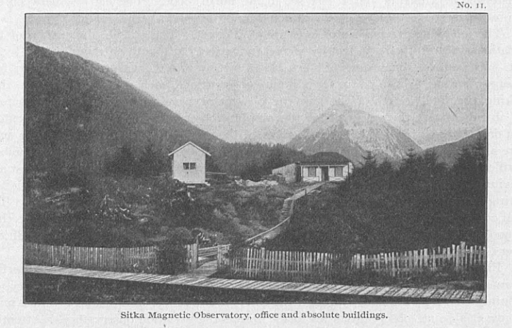
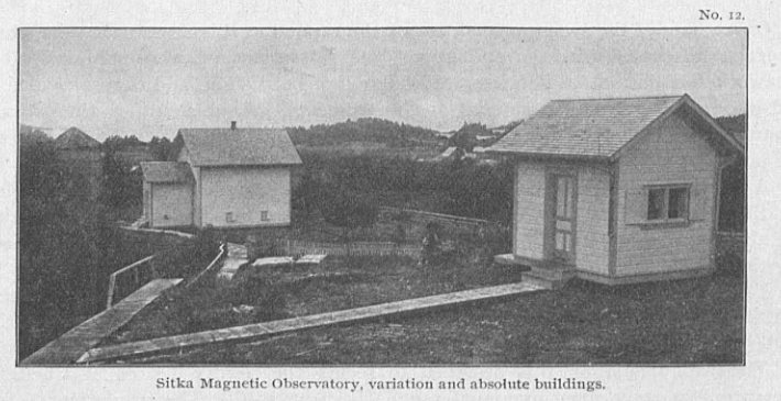
The station was originally built to obtain high-accuracy measurements of Earth’s magnetic field. A U.S. Coast and Geodetic Survey report from 1902 included field notes from H. M. W. Edmonds, the magnetic observer, who arrived in Sitka on July 15, 1901 to oversee construction. He wrote “The weather conditions were very unfavorable for the work of constructing the buildings on account of the almost incessant rain, and the buildings were not completed until October 16. The interior of the building was dried with difficulty, the instruments were installed, and the photographic record of the variation of the magnetic forces began on November 25.” (Figures 1 & 2).
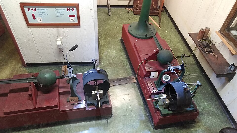
The site quickly expanded, and in 1904, the first seismic station in Alaska was installed on the observatory grounds. The U.S. Coast and Geodetic Survey installed two horizontal pendulums (one oriented north–south, and the other east–west). When an earthquake or other seismic activity occurred, the ground motion would move the pendulums, and the movement of the pendulums was recorded on a rotating drum of paper (Figures 3 & 4). Like with modern seismometers, the information could then be used to locate and determine the size of the earthquake.
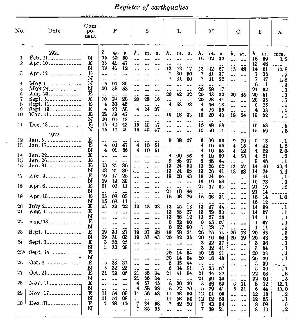
Edmonds included the first seismic update from Alaska in the 1904 U.S. Coast and Geodetic Survey report: “A seismograph was added to the instrumental outfit on November 14, and it was installed in a small room added to the astronomic observatory for that purpose. Observations with this were obtained on sixty-five days before the close of the year.” (The Survey’s report year ran July 1 through June 30.)
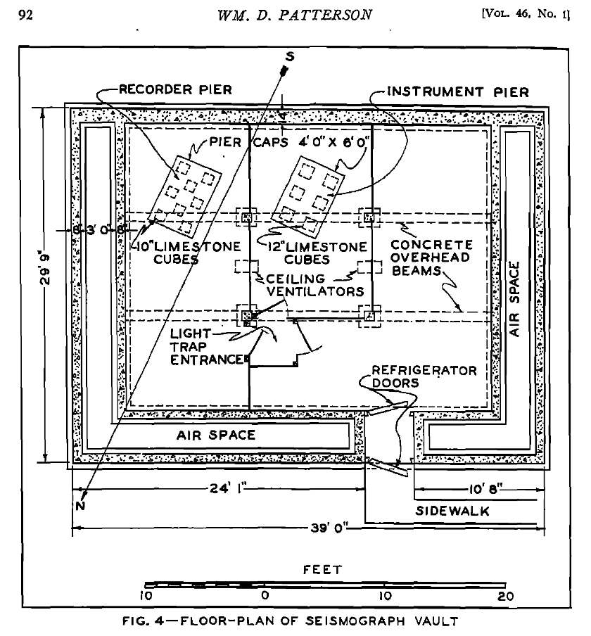
In 1940, the U.S. Coast and Geodetic Survey moved the seismic equipment to a new location in an approximately 1,100 square foot building. In a Survey report, William D. Patterson wrote “The building was formerly used by the Department of Agriculture as a root-cellar, and it was modified by the Coast and Geodetic Survey for use as a seismograph-vault, for which purpose it was admirably suited.The building is set into the side of a low hill and, except for the front wall, is covered with earth. The roof is an arched concrete slab, eight inches thick, supported by reinforced concrete beams and posts, with two concrete ventilators extending through the roof and earth-cover. The floor is of concrete; partitions are of wood. Tile-drains extend around the building and beneath the floor.” (Figure 5)
The Sitka seismic station has evolved since it was first installed. Now housed in a building operated by the National Tsunami Warning Center, a modern broadband seismometer continues to record ground motion in this area. To this day, the Alaska Earthquake Center relies on the data from the Sitka station SIT to accurately locate earthquakes in Southeast Alaska.
Other resources:
R. E. Gebhardt. Sitka Magnetic Observatory of the United States Coast and Geodetic Survey. Journal of Geophysical Research: Terrestrial Magnetism and Atmospheric Electricity, pp. 319-323, Vol. 47, Issue 4, Dec. 1942. https://doi.org/10.1029/TE047i004p00319