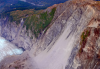
A look at landslide hazards in Alaska. Describes ooperation between communities, state, and scientific agencies to identify, monitor, and prepare for landslide hazards in Alaska. Learn how to identify potential landslides and how you can contribute to the Alaska Landslide Reporter app to alert agencies to potential landslide hazards. Created by the City of Valdez. 
This 60 second video provides information about Tsunami awareness. Created by the City of Valdez.
Information about how to be and stay prepared for a tsunami, with interviews and information about the tsunamis that hit Valdez in 1964, and current ways to create a safety plan. Includes interviews with an Alaska Earthquake Center tsunami scientist and National Tusnami Warning Center staff. Created by the City of Valdez.
Megathrust earthquakes in subduction zones can produce powerful tsunamis. The rock above the plate boundary is being compressed and bent as it stores the elastic energy during time intervals between the earthquakes. When it can no longer hold the stress, the continental plate slides up abruptly along the plate boundary causing the leading edge to push sea water upward and generating a tsunami.

Tsunami energy extends from the surface of the ocean all the way to the bottom, regardless of the ocean depth. This makes tsunami very different from wind waves that disturb only the ocean surface. This property of tsunamis makes it possible to detect them in the open ocean by bottom pressure sensors.

Sudden failure of unstable submarine slopes can produce a movement of large amount of material, which generates displacement of water causing a tsunami. Such failures can be triggered by ground motions of a strong earthquake, extreme low tides and construction activities in ports and harbors.

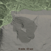
The tsunami floods a coastal town as a fast-moving tide destroying everything on their path. The animation demonstrates one of the important warning signs of a tsunami – the initial retreat of water from the shore and exposure of rocks and fish on the sea bottom. However, ocean doesn’t always recede first; tsunami often comes as a wall of water and quickly inundates the coast.

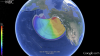
The 28 March 19643 Great Alaska Earthquake generated a powerful tsunami that killed 122 people in the United States. This animation shows the first 6 hours of the tsunami travel. Colors represent tsunami heights, showing that the tsunami energy was mostly directed toward the west coast of the US.

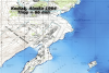
This is a numerical simulation of the 1964 tsunami inundating the US Coast Guard Base. Lighter blue colors represent larger waves.

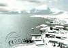
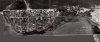
This sequence of three aerial photos of Seward, Alaska show the town just before the 1964 tsunami, a month after the disaster, and in 2003, with the new business development in the 1964 tsunami inundation zone.

This animation shows Seward, Alaska and bathymetry at the head of Resurrection Bay. The landslide material moves down the slope driven by gravity. The slide resulted in damaging local tsunamis in Seward on March 28, 1964.