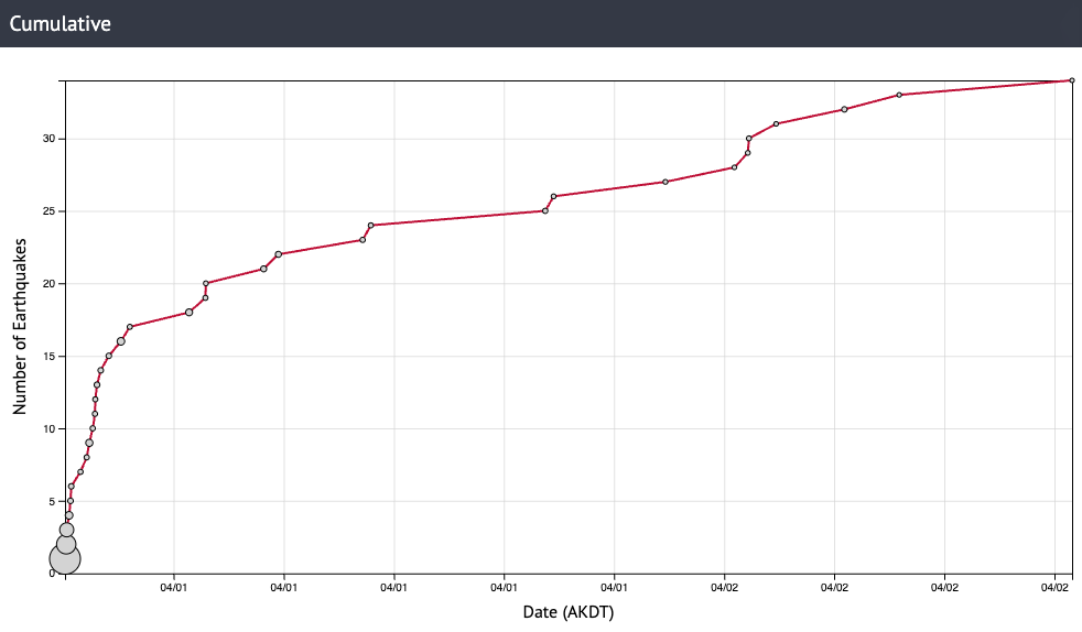
On the evening of March 31, 2025, a magnitude 5.1 earthquake shook the Alaska Peninsula and surrounding area. By the following morning, the Alaska Earthquake Center duty seismologist had reviewed 21 aftershocks (Figure 1).
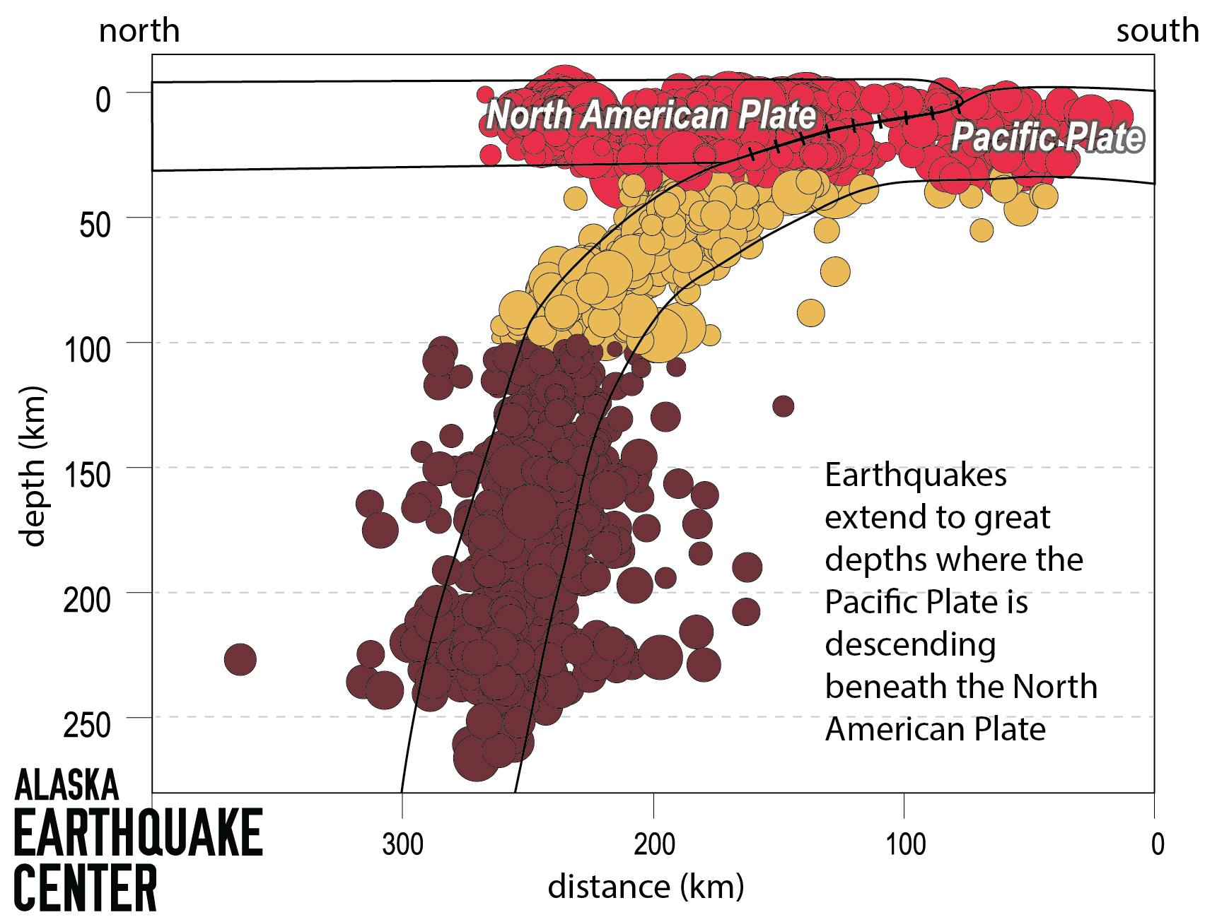
This earthquake was significantly larger than any in the area in the past decade. At a depth of about 7 miles (11 km), it was slightly unusual because of how shallow it was for its size. While shallow crustal earthquakes are generally expected in this part of the Alaska Peninsula due to the distributed stresses of convergence between the Pacific and North American plates, they tend to be less than magnitude 3. More typical deeper and larger earthquakes trace the descent of the Pacific Plate under North America at depths of 75 miles (120 km) or greater in this location (Figure 2).
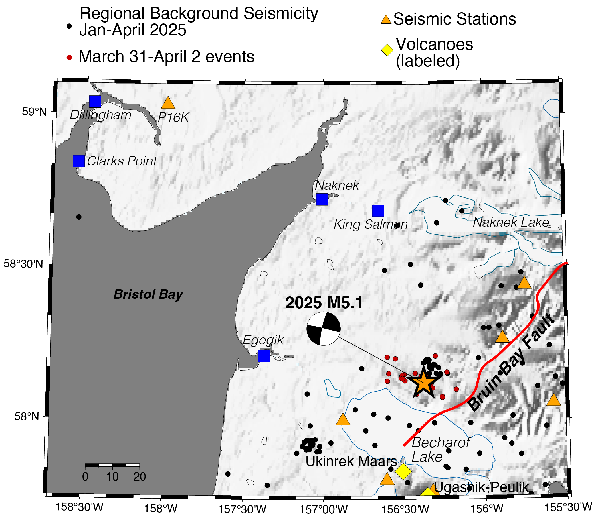
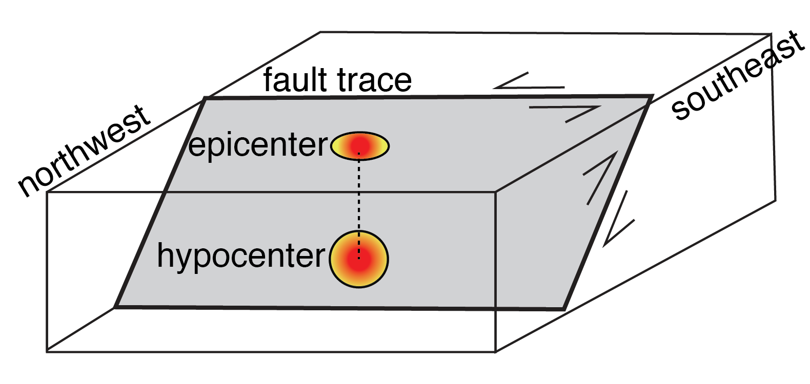
The fault mechanism for the M5.1 event (Figure 3) was also somewhat mysterious at first glance, because Alaska’s southern boundary is known for thrust faulting associated with the compressive forces of subduction. This earthquake, however, resulted from lateral/horizontal fault slip.
Details about the depth of an earthquake and what type of slip produced it helps geologists understand the nature of active faulting in this spot.
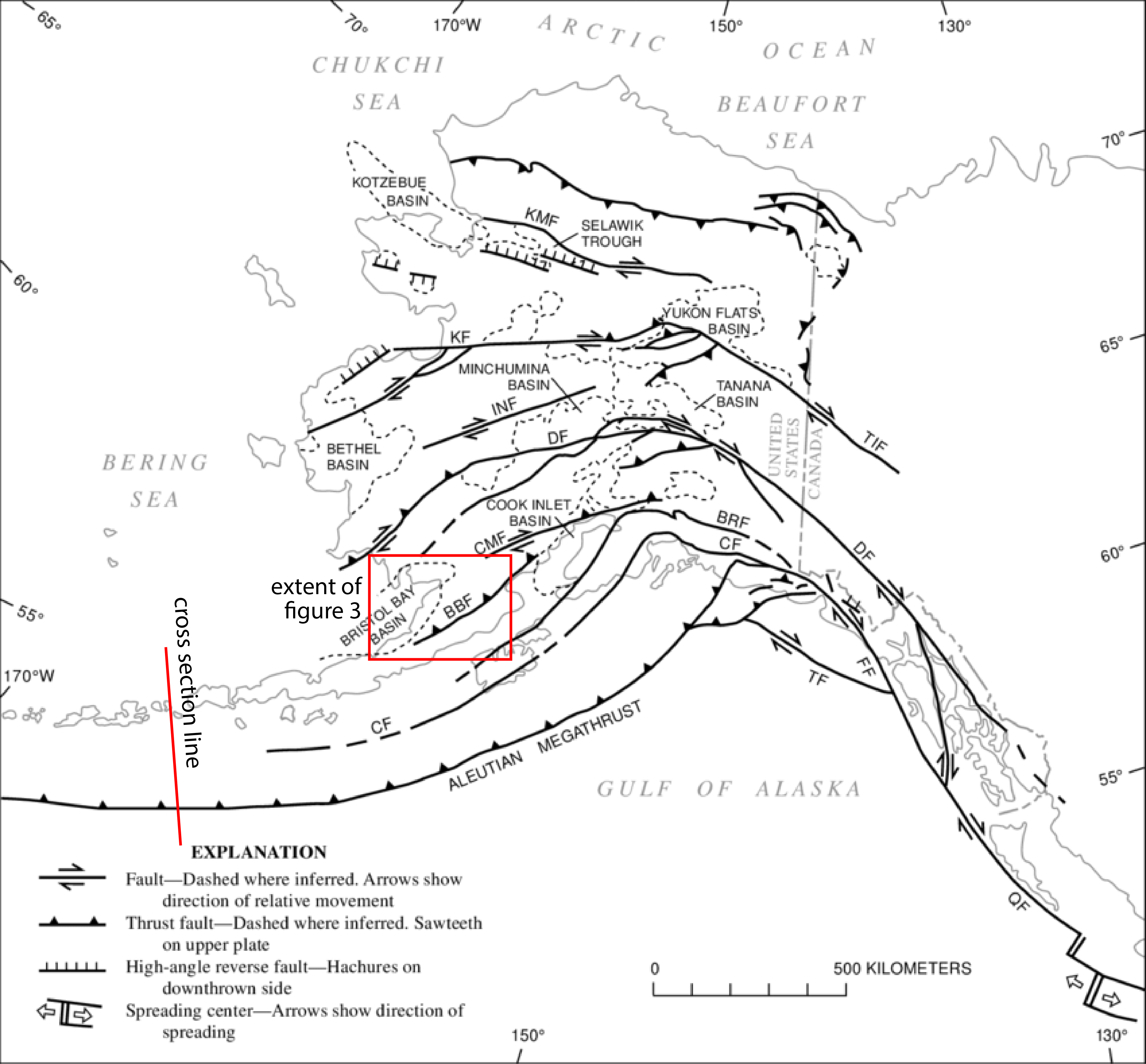
The only mapped fault in the vicinity of the M5.1 earthquake is the Bruin Bay Fault (Figure 4), which was recently investigated because of its potential influence on petroleum-bearing rocks of the Cook Inlet area. This fault is considered to have accommodated both compressive and lateral slip (Figure 3). Although the earthquake epicenter was northwest of the fault trace, combining the northwest tilt of the fault plane with the depth of the event places it on that fault (Figure 5).
Alaska Division of Geological and Geophysical Surveys geologist Robert Gillis, an author on a 2017 study of the Bruin Bay Fault*, says that while the fault is not known to be active, it is poorly studied on the Alaska Peninsula. “It is conceivable that the fault is active along its southern reaches,” he says.
The Alaska Earthquake Center focuses on the faults that produce significant shaking and pose risk in modern times. This earthquake reminds us that some of these structures have a long history. Slip along the Bruin Bay fault is documented to date back to the Jurassic period, close to 200 million years ago. That it can still produce earthquakes today points to how long-lived geologic structures can be: once-weakened rocks tend to be continued zones of weakness. Understanding such faults helps us better prepare Alaskans for where our earthquake hazards lie.
The earthquake and its aftershocks lie between two well-instrumented active volcanic centers, the Ugashik-Peulik and the Katmai clusters. While the event is not associated with volcanic activity, its proximity to instruments managed by the Alaska Volcano Observatory to monitor the volcanic centers was critical to extracting a well-constrained location and depth.
Ideally, Earthquake Center analysts would rely on 360 degrees of station coverage—in other words, stations on all sides of an earthquake (Figure 3). Dillingham station P16K north of Bristol Bay played a critical role in locating the events of this sequence, providing information where there would otherwise be a significant gap. Coverage to the north and south, sparse as it is, was enabled only recently by our network expansion in 2019-2020.
This midsize earthquake highlights the importance of having a widespread network, to capture events in unusual places that offer insight into the seismic landscape of Alaska.
*This paper may be behind a copyrighted materials paywall.


