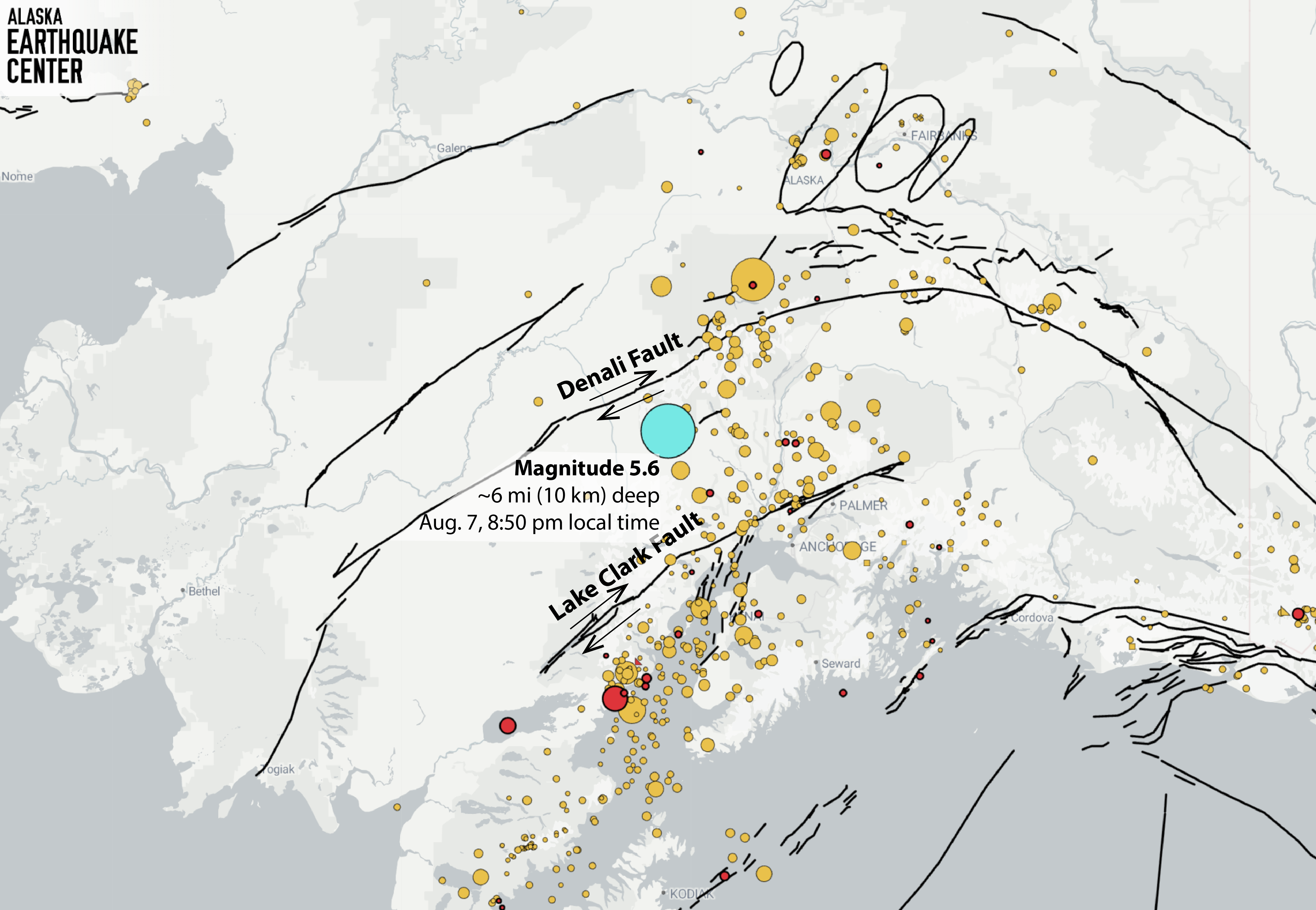
On Friday August 7th, close to 9 pm, the area west of Susitna swayed from a magnitude 5.6 earthquake in the shallow crust (Figure 1). Alaska Earthquake Center seismic data manager Heather McFarlin was on the 24-hour duty shift, and rapidly verified the location and magnitude. Within an hour of the quake, over 1,000 people had logged in to the U.S. Geological Survey “Did You Feel It?” site to report what they had experienced.
On our social media pages, we heard from a few people that the shaking from this quake “felt like being on a boat.” Reported shaking intensities were mainly in the II to IV range, or from hung objects swinging up to dishes and windows rattling. How shaking is received in any location depends on many factors. Both the type of the motion and how far away it was felt (the farthest report was from 205 miles, or 330 km, from the epicenter) are consistent with an earthquake in the shallow crust.
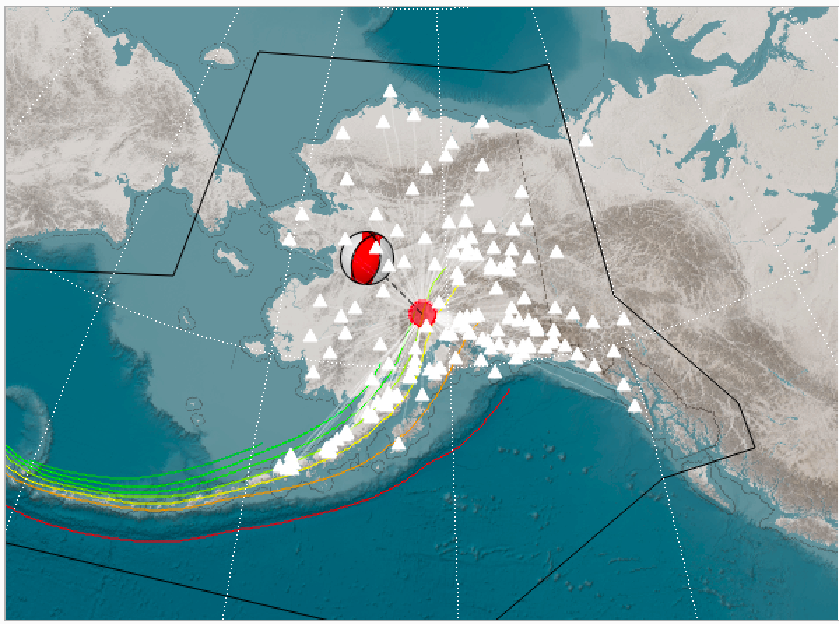
The type of motion that produced the earthquake is remarkably consistent both with its shallow depth and what is geologically known about the area. Horizontal (right-lateral) slip along the Denali Fault to the north, and the same type of slip along the Lake Clark Fault to the south, (Figure 1) cause the region in between to rotate counter-clockwise and be squeezed east–west (Figure 2).
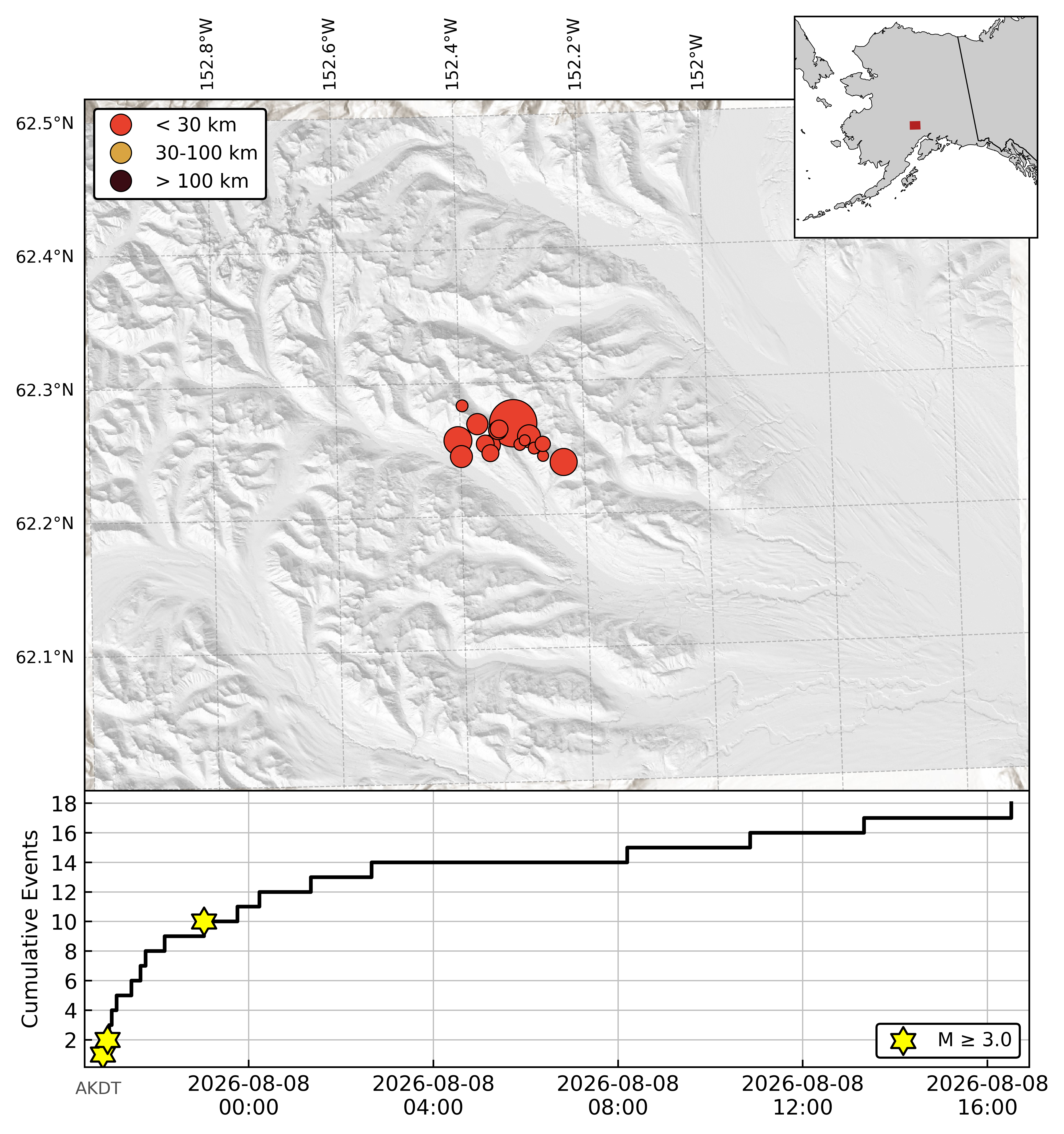
There have been 18 aftershocks in this sequence in the 24 hours since the main shock (Figure 3), the largest a magnitude 3.4. The USGS aftershock forecast suggests only a four percent chance that aftershocks from this event will exceed a magnitude 4.